
The length of the Bhutan India border was 605 kilometers until recently. According to the Border Management Department of the Ministry of Home Affairs (MHA) in New Delhi – now it is updated to 699 kilometers. The increase is not through extension but inward protrusion of the border deeper into Bhutan.
Besides increasing the zigzag, the initial border has been moved inside Bhutan in several locations. Bhutan shares border with four Indian states- Arunachal Pradesh, Assam, West Bengal and Sikkim from east to west on the southern side.
It is election time in Bhutan and the government of India (GoI) is busy fixing the Bhutan-India international border. Until recently Bhutan China border mismatch was in the news. The border between Bhutan and India appeared normal as if there was no dispute anywhere. The disputes were limited to the red-carpet diplomacy parties. There was no discussion of any dispute neither in New Delhi nor in Thimphu. At a time when the Bhutanese people and media are busy in the election and there is an interim government in Thimphu, the work of demarcation of the Bhutan India International border is at its peak.
The work has started from the Assam Bhutan border. Approved by the Ministry of Home Affairs (MHA) in New Delhi, funded by the Border Management Department of the MHA, the field work is being carried out by the State Home Department of Assam. They are using LIght Detection And Ranging (LIDAR), a laser-based aerial mapping and fixing laser technology along the border. The LIDAR surveying method uses pulsed laser (infra-red) light to measure the target object. It can find the movement of animal, vehicles, people, as well as the changes in the physical structures like the construction or destruction of buildings or the natural phenomenon like landslides and erosion. It makes digital 3-D pictures of the target. It works in all weather conditions.
The idea of the survey is also to study the movement of people, wild animals and vehicles crossing the border and to take necessary actions.
Unusual to the previous maps, where there are large rivers the border has been pushed inside Bhutan up to the point where the river exits mountains for plains.
In several places the tea states and cultivation from Indian sides have been taken into Bhutan.
Election silence
On 15th September 2018, four political parties jumped into primary election. People voted for the parties and selected Druk Nymrup Tshogpa (DNT) and Druk Phensum Tshogpa (DPT) to compete in the general election. The winner forms the government and runner-up stays as the opposition.
DNT is facing the general election for the first time. DPT has experienced ‘political affinity’ doubt from the end of New Delhi in 2013, when it showed symptoms of friendliness with China. Once beaten twice shy- the DPT may not dare to question India for decades to come if it wants to maintain a presence in Thimphu. DNT has been the eye witness of the 2013 Indian influence on Bhutan.
The DPT had 45 out of 47 seats in the parliament between 2008 and 2013. In 2012, the DPT Prime Minister shook hands with his Chinese counterpart and accepted a couple of ambulances from China as a grant. On the eve of general election of 2013, the GoI withdrew its subsidy on fuel that it had been providing, to teach DPT a lesson, with a message to the voters that the subsidy would be regularized only after outing the DPT. The DPT lost the election and two parties changed their roles.
Bhutan has the upper house, National Council, in place. It is an apolitical body. It has new members elected on April 20, 2018 who have little exposure to the existing situation. The powerful National Assembly is yet to be formed. The two parties DNT and DPT will get people’s mandate on 18th October 2018 only. But there is little hope from them, regardless of the position they win in the election. They have a pretext that the demarcation was done before they were elected and hence not the share of their wrong doing.
DNT, an eye witness to the GoI’s almighty role in Bhutan is silent. DPT had an expensive lesson. The media is silent as if ignorant and the GoI is fixing the border.
During the first leg of the exercise the demarcation team is re-fixing the 280 km Bhutan-Assam Border. Bhutan has border with three districts of Assam: Baksa (90 Km), Chirang (70 Km), Kokrajhar (40 km) and Udalguri (80 Km). The plan in the pocket is to mark the entire 699 km Indo-Bhutan border that includes Arunachal Pradesh (217 km), West Bengal (183 km) and Sikkim (32 km), the laser-mapping has begun from Assam.
While the demarcation is a must activity between adjacent neighbors, the time of demarcation and a rat’s way in the process smells rat.
The Constitution of Bhutan specifies that “The international territorial boundary of Bhutan is inviolable and any alteration of areas and boundaries thereof shall be done only with the consent of not less than three-fourths of the total number of members of Parliament (Article 1.3).”
There seems no involvement of the elected members of the parliament. May the newly elected parliamentarians and the media study the ground realities and unravel the truth.
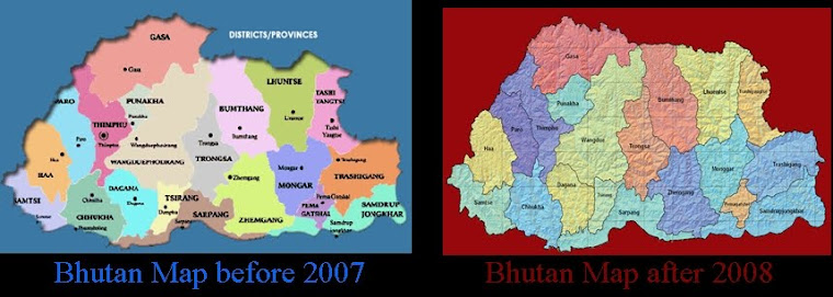
Exactly the same scenario had taken place in 2007. There was an interim government in Thimphu before the 2008 election. During the time of Interim government and election, the northern region of Bhutan including the Mt.Kulakangri the tallest mountain of the country was categorically ceded to China.
Govinda Rizal, the contributing editor of the Bhutan News Service, is the author of the book ‘A Pardesi in Paradise’.
http://www.bhutannewsservice.org/india-protrudes-deeper-under-the-cloud-of-election-in-bhutan/
No comments:
Post a Comment