
By: Govinda Rizal

Photo Source: Google
In early June 2017, Indian defense intelligentsia found Chinese People Liberation Army (PLA) active near Doka-la plateau at the four-state junction between Bhutan, Tibet (China), and Sikkim and West Bengal (India). Between November 2015 and June 2017 about 10 kilometers of roads were constructed in the region that was under dispute for a long time. The construction included 2.3 Kilometer road in the eastern notch of East Sikkim and about 8 km inside western highland of Sombaykha block, Ha district of Bhutan.
Ever since the Bhutan began to appear in maps Dok-la, a part of Doklam plateau was on the map. Doklam plateau is the Tee area of strategic location worth owning. Any country would fight to own such a strategic point and the three countries have anchored their wants.
Bhutan owns it, China wants it and India stunts its use.
For several years, around the month of May, Indian news media have been keeping the Bhutan-China border issues in their annual to-do list of news. The June 2017 episode was a sequel of the past years’ exercises. Indian defense leaders cautioned the leaders in Thimphu regarding the Chinese approach from the west. Thimphu responded hypo-seriously at par the annual China- India ritual. The ritual gained no recognition.
In the mid of June 2017, the director general of the Border Roads Organization (BRO) of India, Lt Gen SK Shrivastava visited Bhutan. In Bhutan BRO that has been working in the name of project DANTAK since 1961 has been constructing and maintaining roads along the Indian border and supervising the international border. On 20th June 2017, senior army officers of India and China had a meeting over the crossing over of China-India borders by each other’s forces. The two sides had repeatedly accused each other of cross-over at Sikkim (India) – Tibet (China) border 200 meters to 2 kilometers west of Bhutan border. The conclusion of the meeting was not made public, most probably because there was no conclusion at all.
Bhutan received an appraisal of the situation. The Bhutanese side agreed to send a démarche to Chinese authorities through its diplomatic channel. The démarche carried the words of Indian government and the authority of the Bhutanese government. Although the démarche was sent through a diplomatic channel, its contents got leaked to the media. It had an impact. Both the Indian and Chinese media gave priority to the news. With Bhutan under its cordon, the Indian news media waged a war of words against China. The Chinese media, which used to be quiet and calculated, was hyperactive this time. Chinese diplomats namely, Lu Kang, the Director-General, Department of Information, Ministry of Foreign Affairs and Foreign Ministry spokesman Geng Shuang fueled the debate with their responses. A volley of claims and accusations were exchanged between the two sides of the Himalayas.
The torrent of news from both the sides of the Himalayas made the people think there was a war in the otherwise desolated plateau. The Chinese authorities claimed that they had a perpetual understanding with the Bhutanese side. The Indian authorities announced that it would be solved diplomatically. The official announcements got into a ditch of news propagandas.
Doklam which in Dzongkha and Tibetan languages means a ‘rocky path’ was an out-of-bound region for both the Bhutanese and Tibetans, since the 1960s. Herders of both countries frequently used the region for pasture. The rocky path turned into a desolated region after the Bhutan –China border disagreements began to spill to the public since 1988.
Both Bhutan and China claim the region based on some maps of independent times in their histories. Several scholars believe that it was a region of Tibet instead of Bhutan to justify the Chinese claim. Tibet got independence from China in 1912 and lost its sovereignty back to China in 1951. During the independent Tibet era, there was no civilization in the plateau. However, the major trade route between Bengal (India) and Tibet passed from the vicinity of the plateau. China produces the maps of the region before the Tibetan Independence as its claim over the area.
On the Bhutanese side, it’s not a claim but an effort to prevent cede of the region. Bhutan was unified in the seventeenth century but the borders are amoebic until today.
China, with its area of about 250 Bhutans, won’t grab the plateau at the cost of blooming bilateral camaraderie. It desperately wants the strategic site in exchange for more land in the north. It wants to tryst with Bhutan outside the influence of India. Until 2010, Bhutan and China had borders issues to resolve in at least seven regions. Technical teams from both the countries have prepared maps and resolutions in unison. The remaining contention has been over Doklam region that is associated with the security concern of India. India perceives the icicle shaped Yadong County between Bhutan and Sikkim as a Chinese claw near its wasp-waist that connects its north eastern states to the mainland India. Chinese fleets have been traveling thousands of miles to reach South Asia crossing three seas and two oceans, making the trade expensive. If roads connect Yadong and South Asian cities, the travel time will decrease by a week. The distance from Dok-la Plateau to Banglabanda Zero Point or the gateway to Bangladesh is less than 150 km by land or about 100 km aerial distance. No one can rule out the Chinese planners’ mulling over strategies to connect to the Bay of Bengal via Yadong. If the connection is not possible through agreements, and the plateau is with China, it could be used in the disagreement. The ongoing Indian cacophony seems more out of the fear of its security, pretexts for protective measures than an altruistic protection to Bhutan.
About 25 kilometers north of the disputed Dok-la is another region of the dispute between Bhutan and China. This area of dispute has been bulged on both the sides for the sake of dispute. At least 2.4 km of the Xigase-Yadong providential road 204 is inside the disputed region on the Chinese side. If Yadong and Damthang (Ha) towns are connected by roads, which are about 40 kilometers apart, it would provide Bhutan with an access by roads to the second country after India. Bhutan and China had agreed in 1998 to work to solve border dispute keeping the status of pre-1959 until an agreement for complete border demarcation. The two sides met at least two dozen times for border talks.
Two districts in Bhutan, Samchi and Ha, adjacent to Doklam region have been bearing the brunt of unsolved Bhutan- China border dispute. India has been a guiding force in Bhutan’s overall as well and selective developments. More than 2500 kilometers of roads in Bhutan are constructed at the India’s initiatives and support, since 1961. Until a year back, Samchi was kept as the only district in Bhutan that was not connected to other districts with a road. Ha was connected to the capital with a road. People travelling between adjacent Samchi and Ha districts had to travel through India and three districts in Bhutan making the two districts 300 km far from each other by roads. In absence of a road and permission to construct one, the people of Ha who wanted to travel to Silliguri in the west had to travel East, south, and west. While Silliguri, the largest Indian city near to Bhutan is the trade center of Bhutan and the North east India, Ha hosts headquarter of Indian Military Training Team (IMTRAT) in Bhutan. The IMTRAT headquarter in Ha is within the vicinity of the Yadong County. IMTRAT imparts training to Bhutanese soldiers. The strategy of the isolation of Ha and Samchi turned out to be faulty and futile. A road construction was initiated to connect Ha to Silliguri through Samchi. Once completed, it will shorten the time of travel between Silliguri and Ha by at least seven hours. On one hand the road connecting Ha and India is near to completion; on the other hand, China seems contented at its negotiation with Bhutan. The contention of Chinese authorities and docile expression of Bhutanese government confirm that the two sides have reached an agreement. Bhutanese leaders who update Indian counterparts on all types of developments must be waiting for a ripe time to do so. Until 2007, Bhutan used to inform India everything regarding its foreign relation. The provision was done away by the India-Bhutan Friendship Treaty, 2007. However, Bhutan’s defense, economy, and finance are pegged on India. It remains India’s responsibility to intervene than interfere when it perceives Bhutan wrestling against an odd. At the peoples’ level, most Indians perceive Bhutan as India’s protectorate. Most Chinese people put Bhutan and Sikkim in one story.
Bhutanese government has distanced itself from China, to feel safe and be protected by India. In 2012, the former Prime Minister of Bhutan tried to be friendly with China. India taught him and his party a lesson. On the eve of the 2013-election, India withdrew the subsidy on fuel and oriented the people to vote for a party more loyal to India. A party of it choice came to the power and India released the budget for Bhutan. India has been Bhutan’s sugar daddy since the start of the latter’s five-year plans in 1960s. Indian money and Bhutanese tact characterize the Bhutan-India relationship. In the past, Indian government instilled Sikkim fear in Bhutanese rulers against its southern population and instigated the local leaders of Southern Bhutan to rise against their rulers. It led to an eviction of one fifth or about fifty percent of Southern Bhutanese from Bhutan. The evicted Bhutanese landed up as refugees in Nepal and struggled for repatriation for decades. India acted as a valve. It used its military force to ferry the people from Bhutan to Nepal and to prevent their return to Bhutan. When the refugees were in Nepal, India used them against Bhutan as a bait of bargain. Indian rebels hiding in Bhutan were negated and India owned the construction and use of hydro-electricity power in Bhutan, among others. Today majority of the Bhutanese refugees are resettled in third countries and the remaining refuges are being locally integrated, India feels its anchor has weakened.
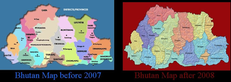
Back in 2007, Bhutan published a map without Mount Kulakangri, its tallest mountain. It appeared ceded to China. Moreover, there was news in the academic circle that Bhutan wanted to cede Samchi district to India with all its Southern Bhutanese population dumped there. Soon after the 2008 elections in Bhutan, the people in exile apprised the new members of the parliament regarding the loss of Bhutan’s mountains, official publication of a faulty map and reduction of the size of the country. The members were silent after a brief discussion in the assembly. School books still mention Kulakangri as the Bhutan’s tallest mountain. The Bhutanese lawmakers, rulers and Indian government silently accepted the faulty map and loss of 8500 Km sq of the land. It makes little sense of the hue and cry when the Chinese proposal is for an exchange of 269 sq Km land in the west in return for 495 sq km land in the north.
While India and China are partners in several fronts, the border between them has been the bone of contention. The two countries fought a bloody war in 1962 and they take pride in not having exchanged a slap there after. India has been finding it difficult to accept China’s intimacy with Pakistan and Nepal. It’s preventive on Bhutan. While India has been a patron to Bhutan, diplomats of two countries in Asia namely Bangladesh and China always highly regard Bhutan. Bhutan was the first country to recognize an independent Bangladesh and the first country to support China’s membership in United Nations Organization.
The present tussle between the two neighbors is not over a grave issue but it seems a pretext to a weighty agenda. The present truce has given a reason to India to post more soldiers in Bhutan. On the justification of the present discontentment India may carry out a nuclear test soon and China may follow it as its repercussion. Both the nuclear powers seem prepared for tests and are inventing convincing reasons. While the big dragon has called the small dragon for a tryst, the elephant trumpets its loss of a partner. The two countries may not waste a bullet for the Dok-la issue; however, the media of the two countries are in a war.
The author’s previous write-up on the same issue is available at Bhutan_China Boarder Mismatch
The views expressed are solely of the author and doesn’t represent that of BNS. -Editors
http://www.bhutannewsservice.org/while-the-big-and-the-small-dragons-tryst-in-dok-la-the-elephant-trumpets-loud/
No comments:
Post a Comment